D-Day Map used by Eisenhower still stands in DIO building
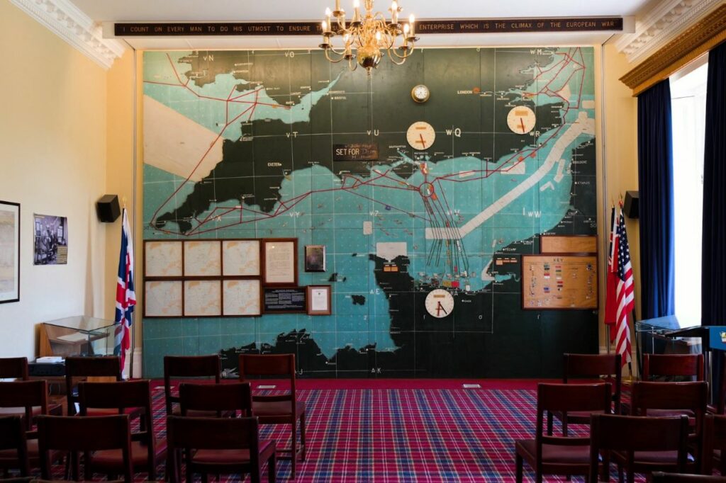
In June 1944, the official order to launch the Normandy Landings was made from a small room in an Officers’ Mess. That room, and the history it holds, is cared for by the Defence Infrastructure Organisation (DIO) as part of …