
Climate change is increasing the frequency of extreme weather events in the UK, which affects infrastructure, emergency services and people’s wellbeing.
I’ve worked on the UK Climate Projections project which has created a useful tool for the MOD to help understand and reduce climate risks that could potentially harm the MOD estate and disrupt services such as the delivery of fuel and food supplies to our sites.
The MOD has committed to adapt and prepare Defence activities and infrastructure to become more resilient to climate change. To support this commitment, the MOD has developed a tool called the Climate Impact Risk Assessment Methodology (CIRAM) to help understand risks and increase the resilience of the MOD estate.

Data from the Environment Agency maps the current risk of river, tidal and surface water and allows us to determine how flooding may affect infrastructure. Similarly, we look at data from other sources, such as the British Geological Survey to find information on groundwater flooding, contamination and geological hazards such as landslides and subsidence. We then bring this data together with the UKCP18 data to consider whether risks are likely to increase in the future and identify areas that require further investigation.
With our in-house Geographical Information System mapping tool, we gather information about specific sites and collate this with mapping information on the local area and issues related to the ecological and historic environment. This gives us a detailed view of the local area, and with all the evidence-based examples and science-based projections we can build a picture of how climate change may affect us in future.
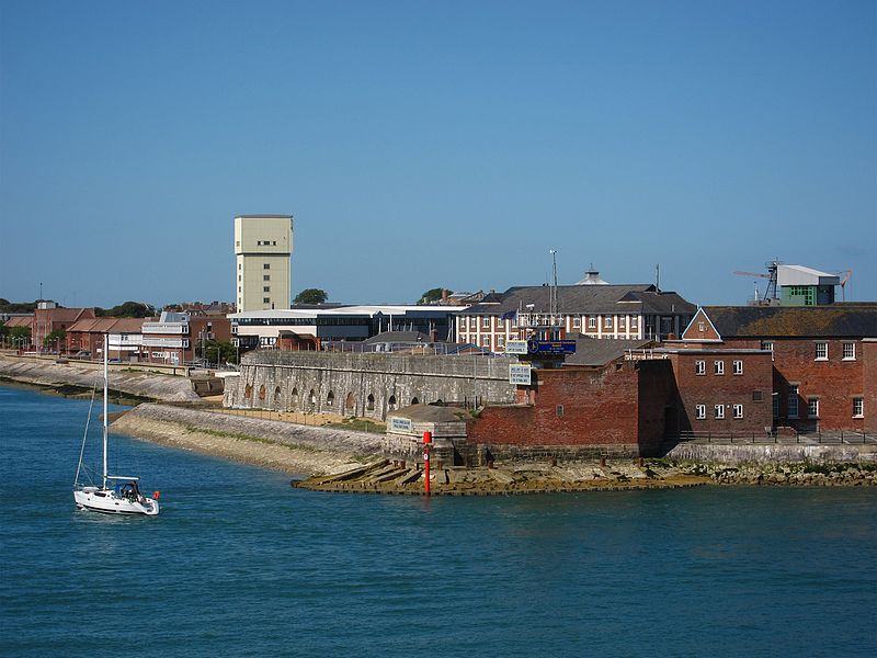
Operational knowledge in the local area converts this assessment into a risk register that outlines how our current operations may be at risk. We recently used this process and scientific data to provide support to emergency repair works for the seawall at Fort Blockhouse. This location is protected by an historic seawall and the prevailing weather and intense storms had damaged the existing seawall infrastructure. The data gave us projections for sea level increases in the area and changes in rainfall, which were used for the risk assessment.
The science-based approach taken by the MOD is important in assessing the risk posed by climate change, allowing us to mitigate those risks in a timely manner and focus on areas that may pose the greatest threat to our operations. Making better informed decisions now, will allow us to operate effectively and make us climate resilient.